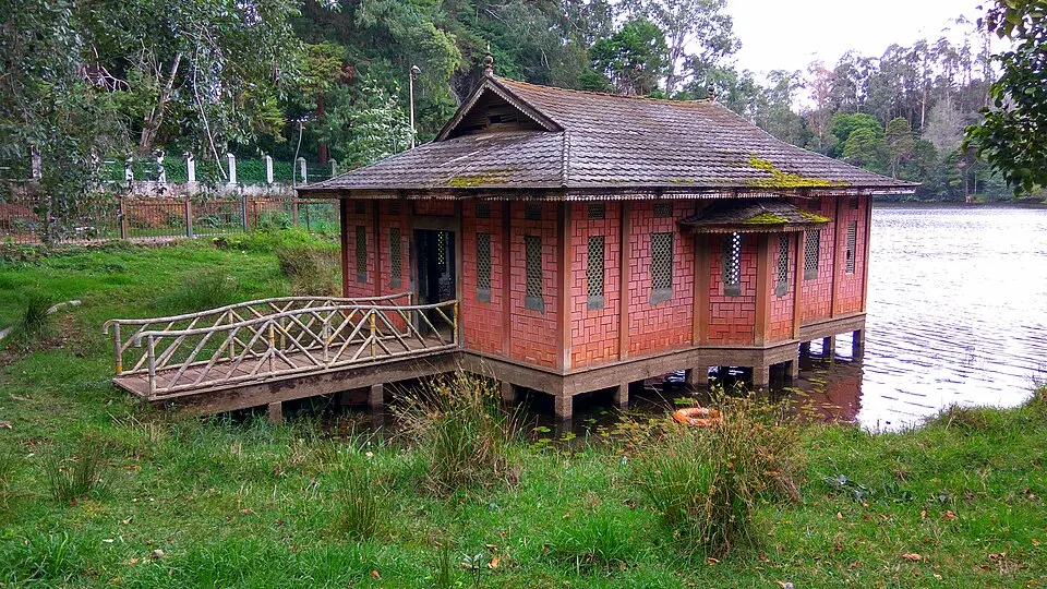
Kodaikanal · Palani Hills · Offbeat Explorer's Guide

Hidden Places
in Kodaikanal

Seven secret corners of the Palani Hills that the tourist buses never stop at — forgotten waterfalls, mist-locked ridges, ancient forest paths, and silent village mornings where you might be the only stranger for miles.

🗺️ 7 Secret Spots 🥾 All Difficulty Levels 📍 Directions Included
Scroll to explore

Beyond the Lake & the Viewpoints — The Kodaikanal Nobody Talks About

Most visitors to Kodaikanal follow the same circuit: Kodai Lake, Coaker's Walk, Pillar Rocks, Silver Cascade, and Bryant Park. It's a fine circuit. But it is not the real Kodaikanal. The real Kodaikanal lives an hour's drive from the tourist strip — in silent shola forests that haven't been photographed a thousand times, in high-altitude lakes where nobody pedals a fibreglass boat, in farming villages where the smell of garlic fields at dawn is the only alarm clock anyone sets.

This guide maps seven such places. Some require forest permits. Some demand an early start and a reliable vehicle. A couple are simply roads most visitors never think to turn down. All of them reward the effort with something the crowded viewpoints can't give you: the feeling of genuine discovery in one of South India's most beautiful hill stations.

Places Covered
7 Hidden Spots
Altitude Range
1,800–2,500 m
Best Season
Oct – Jun
Difficulty Levels
Easy to Hard
Permit Required
2 of 7 Places

Quick Summary Table

A fast overview of all seven hidden places — what each is best for, how long to allow, and how difficult the visit is.

Place Best For Time Needed Difficulty
Mannavanur Lake Landscape, solitude, sunrise 2–3 hours Easy
Berijam Lake Wildlife, birdwatching, forest drive Half day Easy (permit needed)
Fairy Falls Waterfall, short trek, photography 1.5–2 hours Moderate
Kukkal Caves History, trekking, cave exploration 4–5 hours Hard
Vembadi Peak Summit views, serious trekkers Full day Hard (guide required)
Poombarai Village Village life, terraced farms, sunrises 2–3 hours Easy
Pambar Shola Forest Birding, shola ecology, quiet walks 2–3 hours Moderate

What Makes These Places Hidden?

None of these spots are secret in an absolute sense — locals know them, some have been written about once or twice. But several factors reliably keep them off the average tourist's itinerary. Understanding why helps you plan for what to expect.

🛤️

No Signboards

Most of these places have no tourist signage from the main road. Without GPS coordinates or a local guide, you'd drive past the turn-off without knowing it existed.

📋

Permit Requirements

Two places require advance Forest Department permits that most visitors don't know about or don't bother obtaining. The process is straightforward once you know it.

🚗

Poor Road Access

Several spots require driving on unmapped village roads or forest tracks. No travel agent puts them on a standard itinerary because they're harder to reach than the classic viewpoints.

Timing-Dependent

Some places only reveal their magic at specific hours — a dawn mist, a late-afternoon light, or a season when the waterfalls are actually flowing. Miss the window and there's less to see.

01
Easy

Mannavanur Lake

The high-altitude lake that feels like another country

📍 28 km from Kodai town
⏱️ 2–3 hours
🎟️ Free entry
🌿 No permit needed

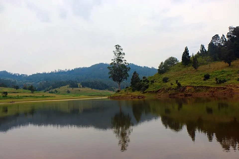
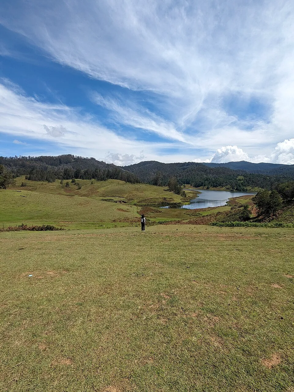
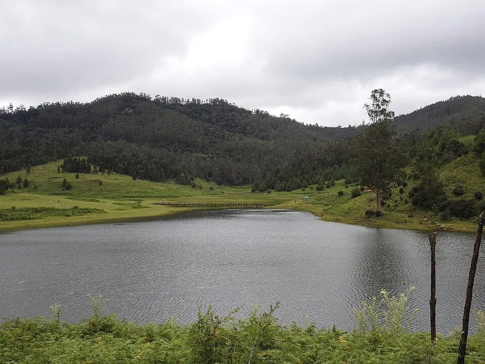
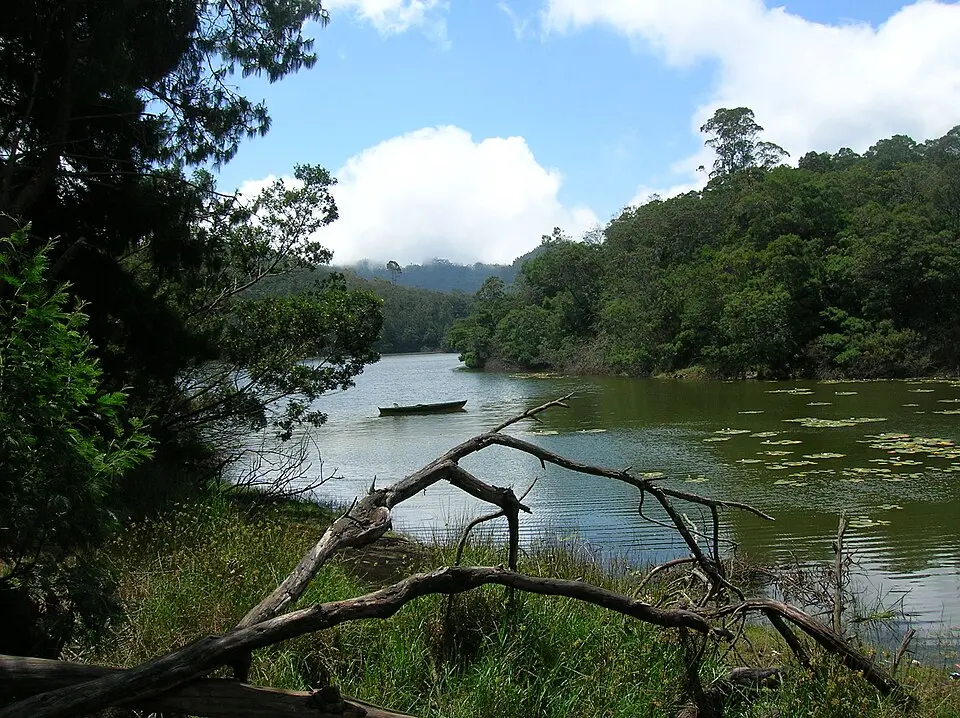
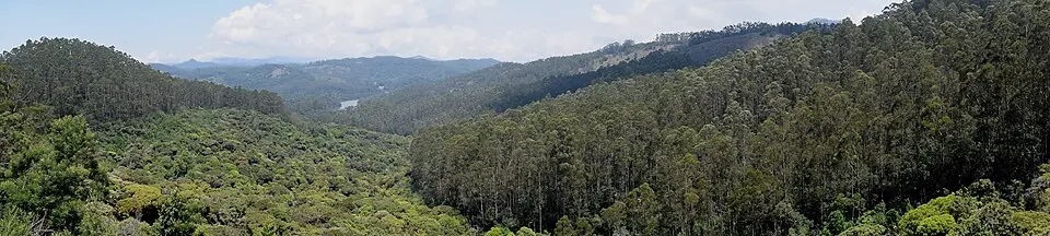
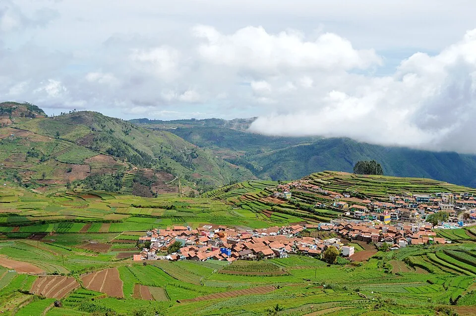
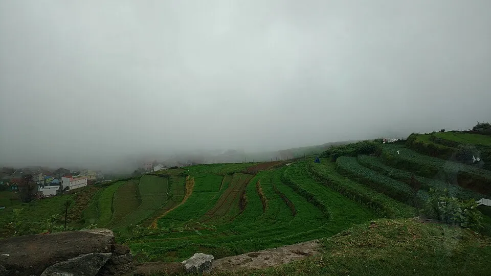
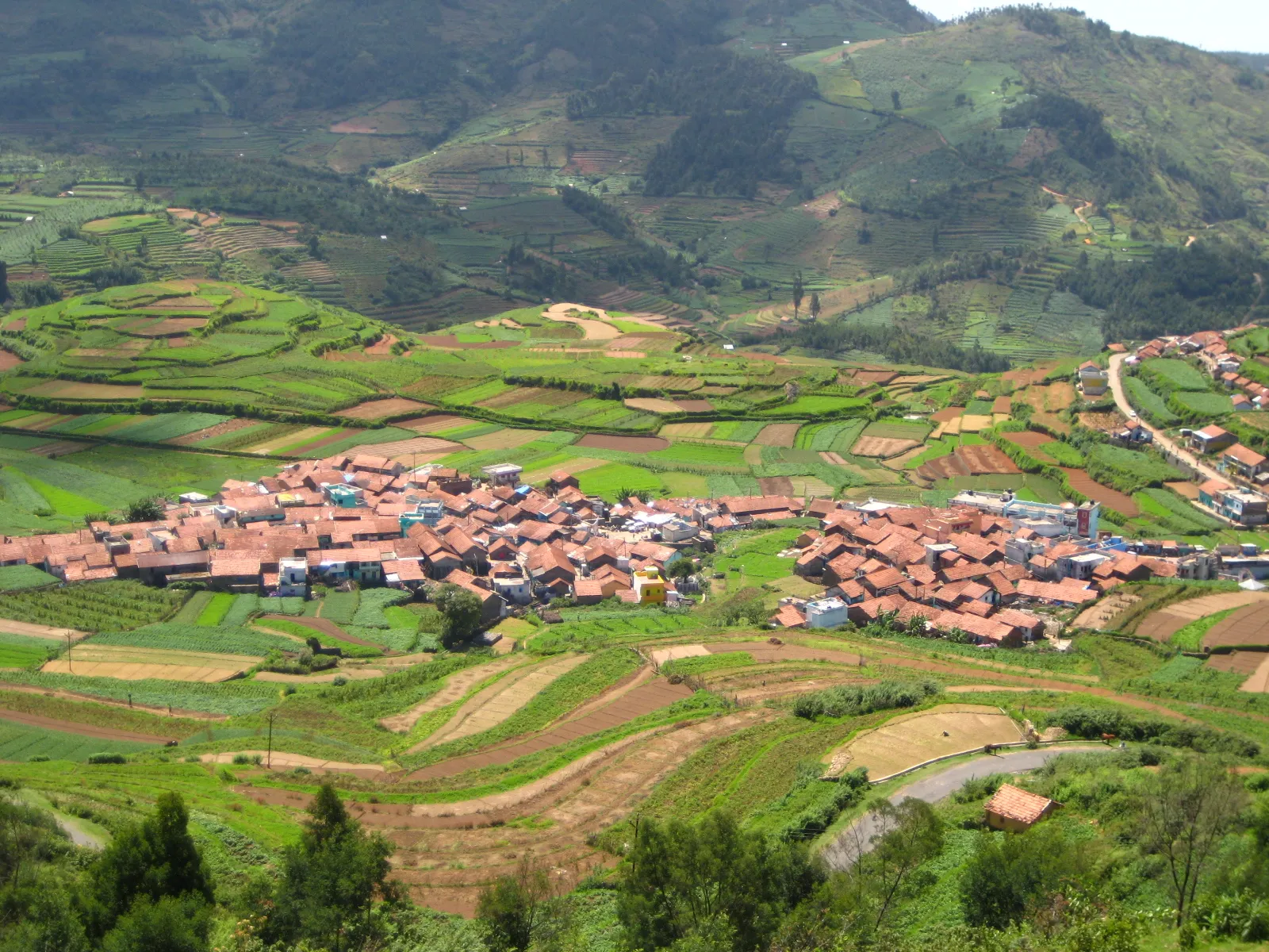
Mannavanur is a small farming village on the Kodaikanal–Palani Road, roughly 28 km from town. Its centrepiece is a tranquil man-made lake ringed by gentle meadows, eucalyptus groves, and the distant silhouette of the Palani Hills. Unlike Kodai Lake, there are no pedal boats, no tourists buying corn on the cob, and no queues. On most mornings you will share it with local farmers, a few grazing cattle, and the occasional pair of painted storks.

🌅

Why Visit?

The sunrise from the eastern bank of Mannavanur Lake — with the hills reflected perfectly in still water and low mist rolling across the meadow — is one of the finest, least-photographed landscapes in the Kodaikanal region. At 1,800 m, the air feels sharper and cleaner than in town.

🗺️ How to Reach

From Kodaikanal, take the Palani Road heading northeast. After about 26 km, look for the Mannavanur Panchayat Board sign on the left. The lake is 2 km down a side road. Hire a local auto or take your own vehicle — no buses serve this route directly.

🕐 Best Time to Visit

October to February for misty mornings and cool air. April to June for clear skies and best water reflections. Arrive by 7 AM to see the lake before local activity picks up. Avoid the monsoon months when the access road can be muddy.

i
There are no cafés or shops near the lake — carry water and breakfast from town.
i
The meadow is private farmland around the edges — stay on the established path around the lake.
i
Rabbit farms line the approach road — a curious sight unique to this village.
i
Phone signal is unreliable past the main junction — download offline maps before leaving Kodai.
02
Permit Required

Berijam Lake

A forest reservoir at the end of a wildlife corridor

📍 21 km from Kodai town
⏱️ Half day
🎟️ Forest permit: ₹150
🌿 Permit needed

Berijam Lake sits at the end of a 21-km forest road inside the Kodaikanal Wildlife Sanctuary, and access requires a permit obtained in advance from the Forest Department office in town. The drive through the sanctuary alone is worth the trip — the shola-grassland mosaic on either side of the road is the most ecologically intact section of forest near Kodaikanal, and gaur, deer, and Nilgiri langurs are regularly spotted on the approach road.

🦚

Why Visit?

The lake is a critical reservoir and a paradise for birdwatchers — Kerala laughingthrush, Nilgiri flycatcher, and white-bellied blue flycatcher have all been recorded here. The silence is extraordinary. No boating is permitted, which preserves the entire atmosphere.

🗺️ How to Reach

Collect your permit from the Forest Range Office on Law's Ghat Road before 9 AM. Private vehicles are allowed on presentation of the permit and vehicle registration. The forest road begins at the Berijam checkpoint, roughly 12 km from town. Two-wheelers are not permitted inside the sanctuary.

🕐 Best Time to Visit

November to March for birdwatching — winter migrants are present. Early morning departures (leave Kodai by 7 AM) give you the best wildlife sightings on the forest road before midday traffic. The lake is closed on Tuesdays for forest staff maintenance.

i
Permits are limited to a fixed number of vehicles per day — arrive at the Forest Office by 8:30 AM on peak days.
i
Plastic carry bags and plastic bottles are strictly prohibited inside the sanctuary.
i
Do not exit your vehicle on the approach road — wildlife encounters can happen without warning.
i
The lake is closed on Tuesdays and on government holidays without prior announcement.
03
Moderate

Fairy Falls

A tiered waterfall hidden behind a eucalyptus ridge

📍 5 km from Kodai town
⏱️ 1.5–2 hours
🎟️ Free
🌿 Short trail

Fairy Falls is only 5 km from Kodaikanal town, yet most visitors never find it. The trailhead is unmarked, reached by a narrow lane off the road to Vattakanal. The falls themselves drop in three tiers through a mossy rockface, surrounded by dense fern cover and the persistent sound of unseen birds. In the post-monsoon months (October–November), the falls are at full flow and the rocks are draped in dark green moss that gives the spot its name.

💧

Why Visit?

The short 20-minute walk through eucalyptus forest to reach the falls is beautiful on its own. At the falls, the natural rock pool at the base is safe for wading (not swimming). The damp microclimate supports orchids, ferns, and mosses rarely seen elsewhere near the town.

🗺️ How to Reach

From Kodaikanal town, take the road toward Vattakanal. About 3 km along, look for a concrete lane branching left near a small tea stall. Walk or ride 500 m, then follow the footpath downhill through the eucalyptus grove for 15–20 minutes to the falls. Ask locally for "Fairy Falls" or "Kodai Falls Small."

🕐 Best Time to Visit

October to December for peak water flow after the monsoon. Morning visits (before 10 AM) are best for photography — the falls face east and catch soft morning light. Avoid visiting during active monsoon rains when the trail becomes slippery and the water level too high for safe approach.

i
Wear shoes with grip — the final descent to the falls is over mossy rocks that are permanently damp.
i
The falls are on the smaller side outside of monsoon and post-monsoon months (Jan–June flow is reduced).
i
No facilities exist at the site — carry everything you bring back out.
i
The trail from Fairy Falls can be extended to connect with Dolphin's Nose for a 4-hour loop walk.
04
Hard

Kukkal Caves

Iron Age burial chambers in a remote grassland

📍 35 km from Kodai town
⏱️ 4–5 hours round trip
🎟️ Free
🥾 Guide strongly advised

The Kukkal Caves are a cluster of natural granite caves used as burial chambers during the Iron Age (approximately 800–200 BCE), located on a remote high-altitude grassland plateau near the village of Kukkal, about 35 km from Kodaikanal. Archaeological surveys have found megalithic pottery shards and iron implements in and around the caves. The landscape surrounding them — open rolling grassland at nearly 2,200 m with an enormous sky and not a single tourist facility — is unlike anything else in the Palani Hills.

🏛️

Why Visit?

This is one of the most historically significant and least-visited archaeological sites accessible from a major South Indian hill station. The caves themselves are modest in size, but standing in an Iron Age burial ground on a windswept Palani plateau with the valley 1,500 m below you is an experience with genuine weight.

🗺️ How to Reach

Drive from Kodaikanal toward Palani on the main road, turn off toward Kukkal village (signposted). From the village, the cave site requires a 3–4 km walk across grassland. The path is unmarked in sections — hire a local guide from Kukkal village (ask at the village tea shop). Four-wheel drive is not required but a sturdy vehicle is advisable.

🕐 Best Time to Visit

November to March for clear skies and firm ground. The grassland plateau becomes boggy and slippery in the monsoon. Start no later than 8 AM to complete the walk and return before afternoon cloud settles over the plateau. Bring warm layers — the wind on the plateau is bitter even in summer.

i
Do not remove or disturb any stones, pottery fragments, or soil — this is a protected archaeological site.
i
The caves are low and require crouching to enter — not suitable for visitors with mobility constraints.
i
Wildlife including leopard and Indian bison (gaur) have been recorded in the area — do not wander off alone.
i
Carry 2 litres of water per person — there is no water source between the village and the caves.
05
Hard

Vembadi Peak

The forgotten summit above the pine canopy

📍 12 km from Kodai town
⏱️ Full day
🎟️ Forest permit needed
🥾 Guide mandatory

Vembadi Peak is the second-highest summit in the Kodaikanal area after Perumal Peak, reaching approximately 2,450 m. Unlike Perumal Peak, which has a reasonably established trekking culture around it, Vembadi sees almost no organised trekking. The summit is accessed through a combination of shola forest, pine plantation, and open grassland, and the trail is unmarked for much of its length. The summit views take in both the Kodaikanal plateau and the steep eastern escarpment dropping toward Dindigul — a perspective no roadside viewpoint can match.

⛰️

Why Visit?

Vembadi offers a true wilderness trekking experience within reach of a hill station. The combination of shola forest (with its characteristic silence and endemic birds) and exposed summit grassland makes for a richly varied full-day outing. On clear November mornings, the entire southern Tamil Nadu plains are visible from the top.

🗺️ How to Reach

Obtain a Forest Department permit from the Range Office (same office as Berijam). The trailhead begins near the Kodaikanal Solar Observatory road. A registered guide is mandatory — ask your hotel or the Forest Office for contacts. Do not attempt this trek without a guide; the path through the shola is not navigable by map alone.

🕐 Best Time to Visit

November to February for the clearest summit views and most reliable weather. Start no later than 6:30 AM — the summit is 5–6 hours round trip and you must be off the exposed ridge before afternoon thunderstorms, which are common even in the dry season at this altitude.

i
This is a strenuous full-day trek — prior trekking experience and good physical fitness are required.
i
The shola section is always damp and cold regardless of season — waterproof layers are essential.
i
Carry high-energy snacks, minimum 3 litres of water, and a fully charged phone with GPS downloaded offline.
i
Bison and leopard are present in the shola belt — your guide will brief you on protocol before entering.
06
Easy

Poombarai Village

Terraced garlic fields at the edge of the clouds

📍 18 km from Kodai town
⏱️ 2–3 hours
🎟️ Free
🌿 No permit needed

Poombarai is a traditional Paliyar and Paliyan-influenced farming village perched on the southern escarpment of the Palani Hills, reached by a narrow road that winds down from the main Kodaikanal plateau. The village is famous locally for its garlic cultivation — the terraced fields drop in steep steps down the hillside, and in the early morning, when cloud fills the valley below and sunlight catches the upper terraces, the visual effect is extraordinary. This is the Kodaikanal that guide books never quite capture.

🌾

Why Visit?

Poombarai offers the rarest thing in a popular hill station: authentic rural life undisturbed by the tourist economy. The village has a centuries-old Murugan temple, friendly locals who are unaccustomed to but welcoming of curious visitors, and a landscape that genuinely looks like a different country from the plateau above.

🗺️ How to Reach

From Kodaikanal, take the road toward Mannavanur and follow signs for Poombarai. The road is narrow and has steep drops on one side — drive slowly and use headlights. Taxis from Kodaikanal town charge around ₹600–₹800 for the round trip with waiting time. The drive itself takes 35–40 minutes each way.

🕐 Best Time to Visit

November to February during garlic harvest season, when the terraces are most active and the village most visually striking. For the cloud-sea sunrise effect, arrive by 6 AM in the winter months. The summer months (April–June) offer clearer skies but a drier landscape. Avoid post-monsoon visits when the road can be unstable.

i
Ask permission before photographing villagers or their homes — this is a working farming community, not a tourist site.
i
The road to Poombarai is not suitable for large vehicles or buses — only cars and two-wheelers.
i
A small ancient Murugan temple at the village centre welcomes respectful visitors — remove footwear before entering.
i
No phone signal exists in the lower sections of the village — inform someone of your route before leaving town.
07
Moderate

Pambar Shola Forest

A cathedral of ancient subtropical cloud forest

📍 9 km from Kodai town
⏱️ 2–3 hours
🎟️ Free access point
🐦 Birdwatching paradise

Shola forests are a unique, hyper-endemic subtropical cloud forest type found only above 1,500 m in the Western Ghats, and the Pambar Shola near Kodaikanal is one of the most accessible examples. These forests are characteristically silent, gnarled, mossy, perpetually damp, and extraordinarily rich in endemic birds and plants. The canopy is low and dense, the undergrowth laced with flowering rhododendrons in spring, and the air carries a cool earthy smell unlike anything in the pine plantations that dominate much of Kodaikanal's forest area.

🌿

Why Visit?

The Pambar Shola edge offers some of the best birding near Kodaikanal — Nilgiri flycatcher, black-and-orange flycatcher, Kerala laughingthrush, and Nilgiri wood-pigeon are resident species. For naturalists, botanists, and anyone who finds the pine-dominated tourist forests too familiar, the shola is a revelation.

🗺️ How to Reach

Take the road toward Berijam Lake and turn off at the Pambar River crossing sign (about 7 km from town). A footpath follows the river upstream into the shola edge. There is no formal trailhead — ask locally for the "shola path near Pambar check dam." The entry point is free and open, but venturing deep into the shola without a naturalist guide is not advisable.

🕐 Best Time to Visit

November to April is the prime birdwatching window. Early morning (6:30–9:00 AM) is essential — shola birds are most active at dawn and become nearly silent by 10 AM. Rhododendrons bloom in February–March, adding vivid colour to the otherwise deep-green forest edge. The shola stays mist-locked most of the year, which is part of its appeal.

i
Wear earth-toned, quiet clothing — bright colours disturb bird sightings and are conspicuous in the forest.
i
Shola soil is fragile — stay on established paths and avoid trampling the moss-covered ground cover.
i
Binoculars make a significant difference here — bring 8x42 or 10x42 minimum for canopy birds.
i
The damp air can make camera lenses fog up — carry a microfibre cloth and allow equipment to acclimatise.

Map of Hidden Places

A schematic view of all seven locations relative to Kodaikanal town, with approximate directions and distances.

KODAIKANAL TOWN 01 Mannavanur Lake 28 km NE 02 Berijam Lake 21 km W 03 Fairy Falls 5 km SE 04 Kukkal Caves 35 km E 05 Vembadi Peak 12 km N 06 Poombarai Village 18 km SW 07 Pambar Shola 9 km W N S W E Kodaikanal Town Hidden Place Road (approx.)
Schematic map — not to scale · All distances approximate from Kodaikanal town centre

Travel Tips for Offbeat Kodaikanal

Visiting the less-travelled parts of the Palani Hills requires a little more preparation than the standard tourist circuit. These tips make the difference between a smooth adventure and a frustrating day.

Hire a local driver who knows the region — many places require local knowledge to find the unmarked trailheads and permit offices.
Download offline maps (Maps.me or Google offline) before leaving town — phone signal disappears within 10 km of Kodai on most routes.
Apply for Forest Department permits the evening before your planned visit — the office opens at 9 AM and permits for Berijam and Vembadi can run out by 10 AM on peak days.
Carry cash — no ATMs, no card payments exist beyond the town centre. Budget ₹500–₹1,000 per person for permits, guides, and petrol top-ups.
Start early — the magic hour at every one of these places is between 6 and 9 AM. Leaving town by 6 AM gives you the best light, coolest temperatures, and quietest access.
Dress in layers — temperature at 2,000+ m can drop 8–10°C between 6 AM and 10 AM as the sun burns off the mist. A fleece you can stuff in a bag is essential.
Inform your hotel of your plans — for harder treks (Vembadi, Kukkal), leave your expected return time and route with hotel staff as a basic safety measure.
Carry a reusable water bottle — plastic is banned in forest areas and genuinely reduces your environmental impact in pristine places.

Safety Tips

⚠️
Never trek alone in forest areas (Vembadi, Kukkal, Pambar Shola). Leopard, bison, and sloth bear are present in the Palani Hills. Always go with a registered guide or at minimum a known local companion.
⚠️
Weather changes fast at altitude. A clear morning can become thick cloud and rain within 90 minutes above 2,000 m. Always carry a waterproof layer regardless of the morning forecast.
⚠️
Road safety on village roads. Narrow mountain roads with blind bends and steep drops require slow driving (under 20 km/h), horn at every bend, and headlights on even during the day. Do not use these roads after dark.
⚠️
Altitude and cold. Visitors unused to 2,000+ m sometimes experience mild headaches, fatigue, or breathlessness. Rest, hydrate, and do not push through serious symptoms — descend to town and seek help.
⚠️
No emergency services in remote areas. The nearest hospital with full facilities is in Kodaikanal town. For serious emergencies, the fastest route back to help is always the priority over completing a planned trip.

Suggested One-Day Hidden Places Itinerary

This itinerary combines three of the most rewarding and logistically compatible hidden places into a single ambitious day — best suited to visitors with a private vehicle and a genuine desire for early starts.

5:45 AM

Depart Kodaikanal for Poombarai Village

Leave town before sunrise on the Mannavanur Road. Drive slowly — the road has steep drops in sections and mist can reduce visibility to 20 metres. Arrive at Poombarai by 6:30 AM.

6:30 AM

Sunrise at Poombarai Terraced Fields

Watch the sun rise over the cloud-filled valley from the upper terraces of the garlic fields. Allow 90 minutes — this is the most photogenic moment of the day. Explore the village briefly and visit the temple if it is open.

8:30 AM

Drive to Mannavanur Lake (via Mannavanur Road)

35-minute drive northeast from Poombarai. Stop at the Mannavanur junction for tea and breakfast at the small roadside stall — this may be the last food available until you return to town. Arrive at the lake by 9:15 AM.

9:15 AM

Walk around Mannavanur Lake

Complete the perimeter path of the lake — roughly 3 km, 45 minutes at a relaxed pace. The light is still good at this hour. Look for storks and kingfishers on the eastern bank. No facilities — use the time quietly.

11:00 AM

Drive back toward Kodaikanal — Fairy Falls detour

Return via the Vattakanal road. Stop at the Fairy Falls trailhead (look for the tea stall landmark). Walk down to the falls — 20 minutes each way. The mid-morning light hits the falls nicely from the east.

12:30 PM

Late Lunch in Vattakanal or Kodaikanal Town

Vattakanal has several small cafés serving breakfast food through early afternoon. Altaf's and Eco Nut are local favourites. Alternatively, drive the final 5 km into town for a full meal before the afternoon wind-down.

3:30 PM

Optional: Evening at Pambar Shola Edge

If energy and daylight allow, drive to the Pambar Shola access point for a final 60-minute forest walk before the light fades. Return to town before 6 PM. Evening birding here is secondary to dawn, but the forest atmosphere at dusk is remarkable.

Frequently Asked Questions

Do I need a guide for any of these hidden places?

+
A guide is mandatory (Forest Department requirement) for Vembadi Peak and strongly advised for Kukkal Caves. For Berijam Lake, a permit is required but you can self-drive on the forest road. For Fairy Falls, Poombarai, and Mannavanur Lake, no guide is needed — basic directions from this guide are sufficient. For Pambar Shola, a naturalist guide dramatically improves the birding experience but is not required for the forest edge walk.

How do I get the Forest Department permit for Berijam Lake?

+
Visit the Forest Range Office on Law's Ghat Road in Kodaikanal town in person. Permits are issued daily from 9 AM. Bring your vehicle registration document and a photo ID. The permit fee is approximately ₹150 per vehicle as of 2026, with an additional per-person charge of ₹20–₹30. A daily limit on vehicle numbers applies — arrive by 8:30 AM on weekends and holidays to avoid missing out. The office is closed on Tuesdays along with Berijam itself.

Are any of these places suitable for families with young children?

+
Mannavanur Lake, Poombarai Village, and the Berijam Lake forest drive are all excellent choices for families with children. The walk around Mannavanur Lake is flat and easy, and the village atmosphere at Poombarai is engaging for curious children. Fairy Falls is manageable for children aged 8 and above with adult supervision on the rocky descent. Kukkal Caves and Vembadi Peak are not suitable for young children due to distance, terrain, and wildlife considerations.

Can I visit these places during the monsoon (July–September)?

+
The monsoon makes most of these places either inaccessible or unsafe. Roads to Poombarai and Kukkal become dangerously slippery. Berijam access may be suspended. Fairy Falls is spectacular in the monsoon but the trail is treacherous. Pambar Shola becomes even more atmospheric in light rain but flash flooding is a risk on the river path. If visiting in July–September, stick to Mannavanur Lake (the road holds up relatively well) and avoid the trekking destinations entirely.

Is renting a two-wheeler enough to reach these places?

+
A two-wheeler works for Fairy Falls, Pambar Shola, and Poombarai (with care on the narrow road). It is not permitted inside Berijam sanctuary. For Kukkal and Mannavanur, the distance and road quality make a car more comfortable and safer, especially for return journeys after a full day of activity. Vembadi requires a car for the approach regardless. Renting a car with driver for a full day (₹1,800–₹2,500 from Kodai town) is the most practical option for covering multiple places in one day.

What is the single best hidden place in Kodaikanal for a first-time visitor?

+
Poombarai Village at sunrise is the single most rewarding hidden experience near Kodaikanal, and it asks the least of you in return — no permit, no guide, no difficult trail. You simply drive there before dawn, sit on the hillside, and watch the garlic terraces emerge from cloud as the light comes up. It requires an early start and a willingness to leave the tourist circuit, but delivers something genuinely beautiful and completely unlike the standard Kodaikanal itinerary. If you do only one thing from this list, make it Poombarai at 6 AM.
Final Word

The Best of Kodaikanal Is Still Off the Map

Pick one place from this list. Set your alarm, pack your jacket, leave your hotel before the town wakes up, and drive toward something most visitors never bother to find. The Palani Hills are bigger, stranger, more beautiful, and more alive than the tour buses suggest. The only thing standing between you and the real Kodaikanal is the willingness to turn off the main road.

Back to Top